Satellite monitoring · Sentinel-2 · Lithium mining

Salar de Olaroz

Lithium extraction complex by brine evaporation in the Puna de Jujuy (≈3,900 m a.s.l.). The brine is concentrated in open-air evaporation ponds. This dashboard quantifies by remote sensing the pond surface area and its evolution over time, over a georeferenced polygon of 113.6 km². It is a descriptive report of satellite data: it measures surfaces, it does not interpret or evaluate the operation.

Surveyed area 113.6 km² (11,360 ha) Analysis scene Sentinel-2 · 4 May 2026 Cloud cover 0.1% Series 2017 → 2026
2,447 ha
Brine ponds (May 2026)
×5.3
Growth 2017 → 2026 (457 → 2,447 ha)
2
Distinct operations in the polygon
10 m
Sentinel-2 resolution
~5 days
Revisit frequency
10 years
Continuous time series

Methodology and scope

Data source
Sentinel-2 L2A — Copernicus Programme (European Space Agency). Surface reflectance, 10 m resolution.
Surveyed area
Georeferenced polygon of 4 vertices · 113.6 km² over Salar de Olaroz, Susques, Jujuy.
Measured indicator
Evaporation pond surface area (water/brine), detected by NDWI (Normalized Difference Water Index): pixels with NDWI > 0. Discriminates artificial ponds from the surrounding desert; visually verified against the true-colour image.
Scenes
One dry-season pass (May–Sep) of low cloud cover per year (2017–2026) — the dry window avoids seasonal rainfall and isolates the signal of the artificial ponds.
Scope and limitations (explicit statement): the indicator quantifies the pond surface area at complex scale. It is a surface measurement, not an estimate of extracted volumes nor a water balance (which depend on depth, evaporation rate, operational cycle and operational data). Individual pond counting underestimates when adjacent ponds share a boundary. Any reading in those terms exceeds the scope of this survey. Remote sensing provides an objective and repeatable surface measurement — it does not evaluate the operation.
Location

The analysis polygon

Analysis grid of ~5.4 × 17.5 km over Salar de Olaroz. Within the bounding box coexist two pond complexes of distinct operations: the northern fan and the southern rectangular field.

View on Google Maps · satellite 23.606° S · 66.744° W ↗
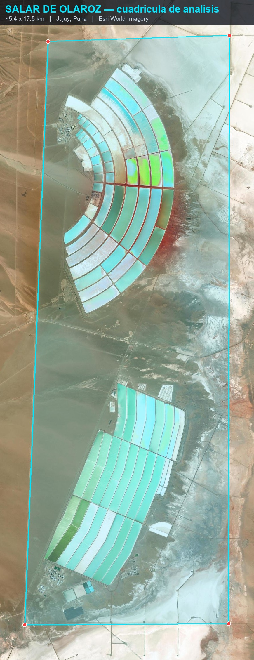
Analysis grid, Salar de Olaroz
113.6 km² polygon over high-resolution image. Both pond fields remain entirely within the bounding box. ⛶ to expand.
Finding · Sentinel-2 4 May 2026

Evaporation ponds: 2,447 ha of brine

On the true-colour image (left), the NDWI (centre) colours water/brine blue and the algorithm marks it (right). The detection matches the exact geometry of the ponds and excludes the desert: 2,447 ha of pond surface area out of the 11,360 ha surveyed (21.5% of the polygon). Many ponds appear white in true colour —brine crystallising in the final stage— and the NDWI still detects them.
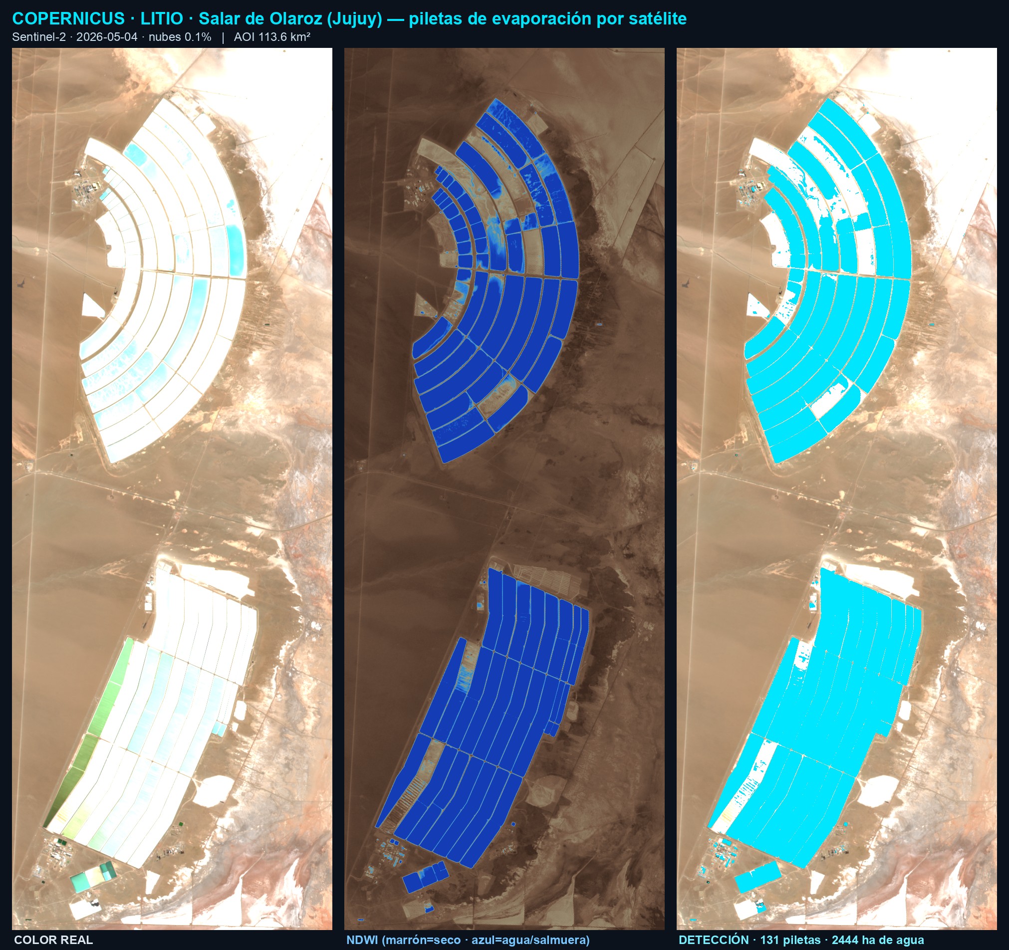
NDWI pond detection, Sentinel-2 May 2026
Left: true colour · Centre: NDWI (brown=dry, blue=water/brine) · Right: detected ponds (cyan) = 2,447 ha. Sentinel-2, 4 May 2026, 0.1% cloud cover. ⛶ to expand.
Field verification

What those pixels are, at ground level

The satellite classification is corroborated against ground-level photographs of the operation itself (Cauchari-Olaroz / Minera Exar, within the polygon). The blue NDWI pixel is real water/brine; the white in true colour is salt crystallising. The colour sequence turquoise → green → white is the brine concentrating stage by stage.
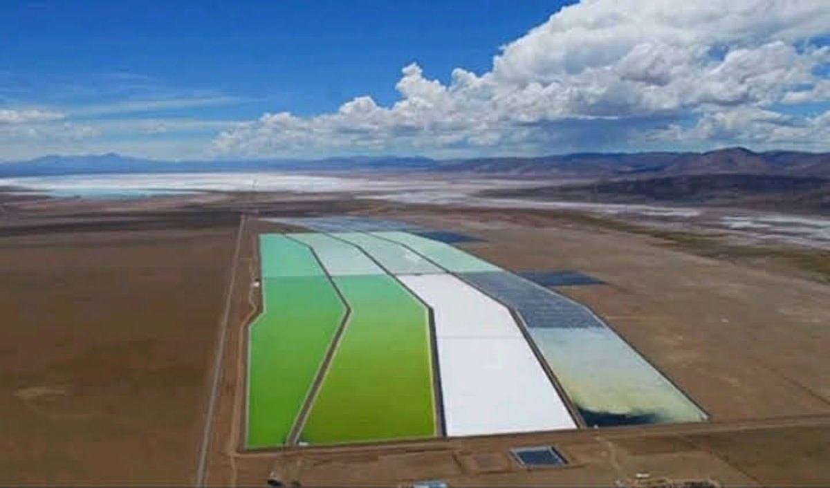
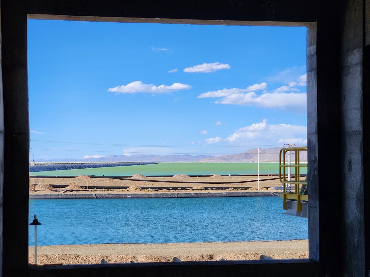
Evaporation sequence: green, white and light-blue ponds
The evaporation sequence. Green pond (concentrated brine) next to the white one (crystallised salt) — the same gradient the satellite sees in true colour.
Turquoise brine ponds at ground level
The brine surface. Intense turquoise with salt edges: exactly the pixels that NDWI marks as water.
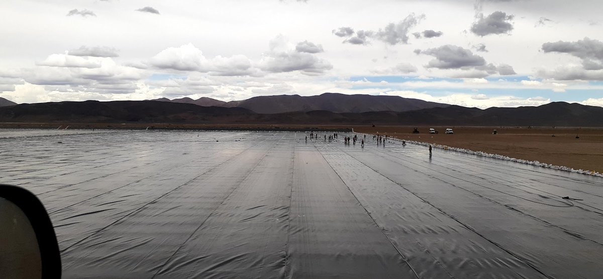
HDPE geomembrane installation in a new pond
Pond under construction. Freshly laid black HDPE geomembrane: confirms on the ground the "dark panels" that the satellite series detects when a new pond appears (visible in 2020).
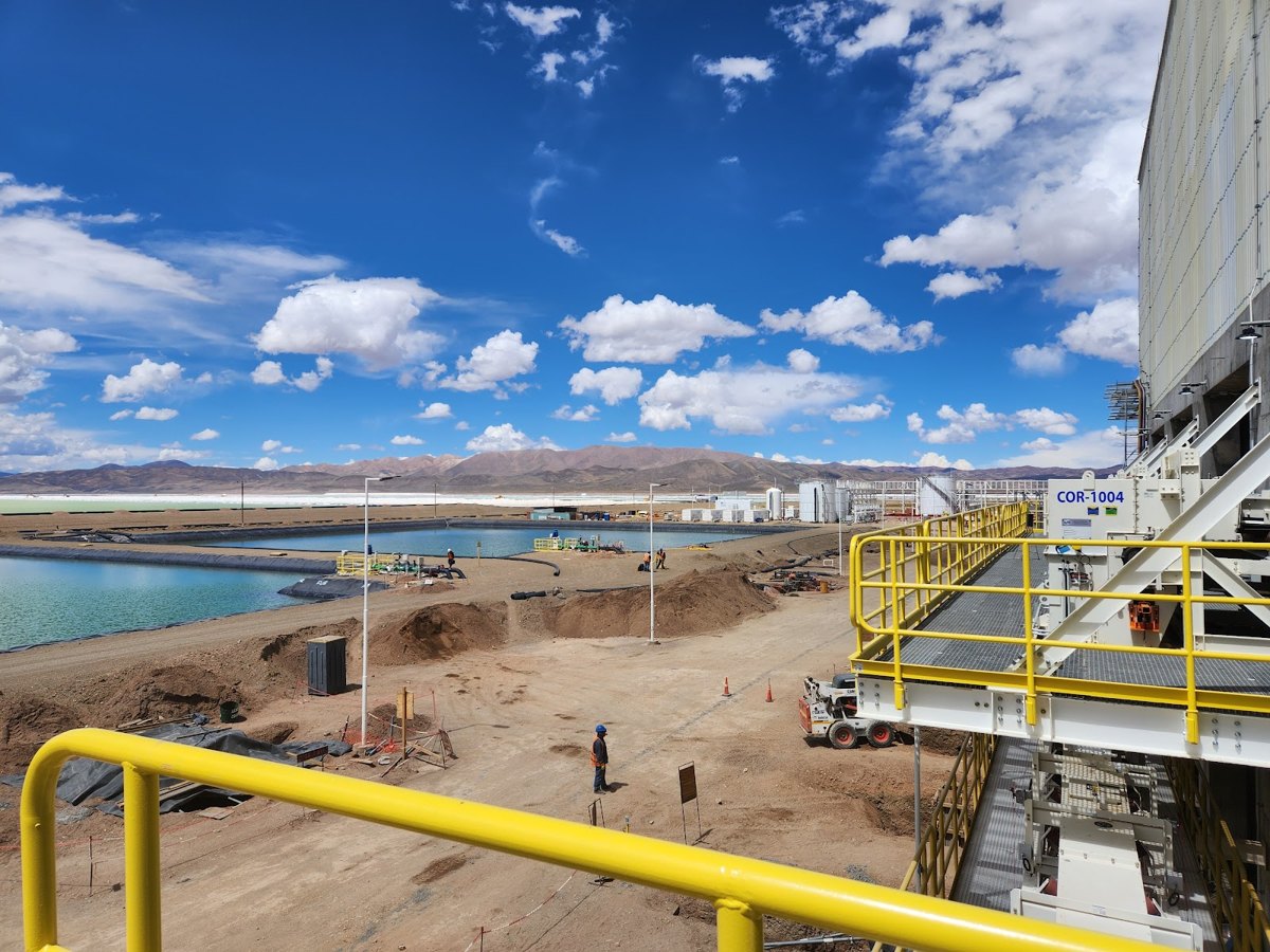
Processing plant and operation ponds
Scale of the operation. Processing plant and ponds — the infrastructure behind the 2,447 ha measured from space.

Publicly accessible reference photographs (Google Maps) of the operation, used to corroborate the satellite classification. Replaceable by proprietary survey or licensed material in formal reports.

Trend · 2017 → 2026

The pond footprint multiplied by 5.3

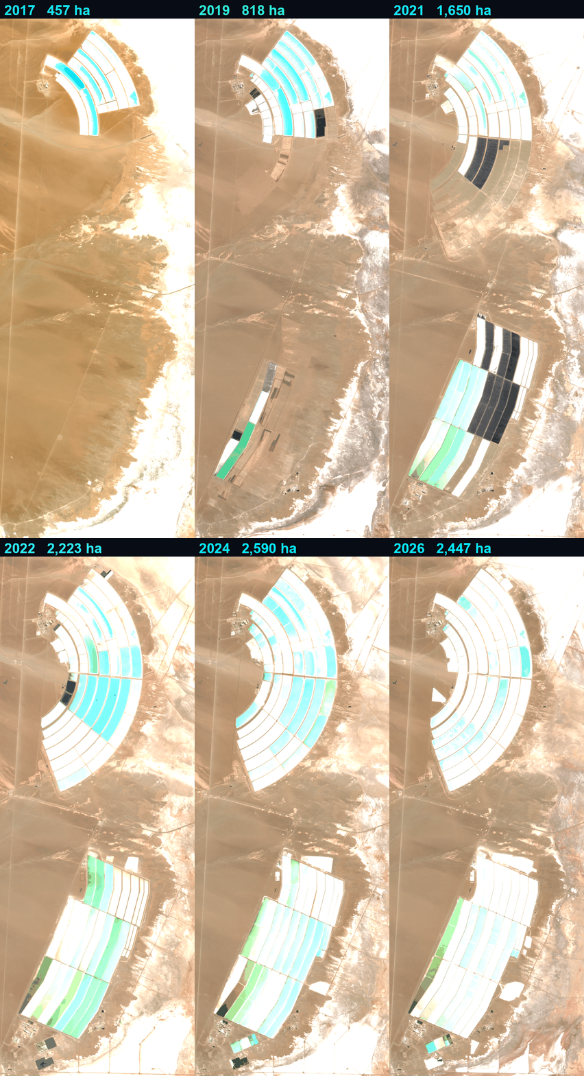
The same polygon and the same method, one dry-season pass per year. The pond surface area went from 457 ha (2017) to 2,447 ha (2026). In 2017 the southern field did not yet exist; it appears under construction around 2020 (freshly waterproofed, dark ponds) and is completed around 2023. Since 2023 the footprint has stabilised at around 2,400–2,600 ha.
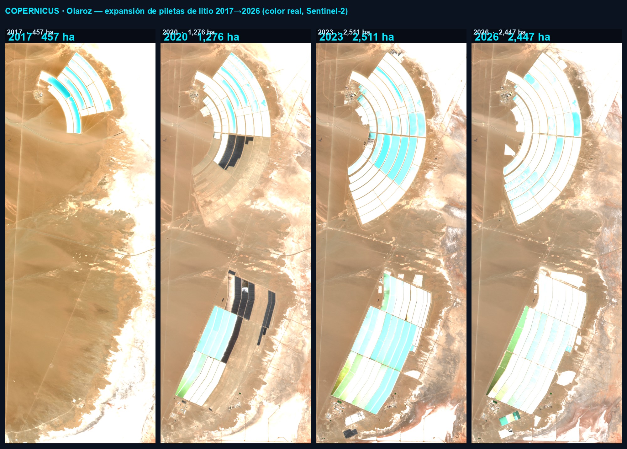
Pond expansion 2017 vs 2026
Sentinel-2 true colour in key years: 2017 (457 ha) · 2020 (1,276 ha) · 2023 (2,511 ha) · 2026 (2,447 ha). ⛶ to expand.
Timelapse 2017–2026 Salar de Olaroz
Timelapse 2017 → 2026 (10 dry-season passes). ⛶ to expand.
Pond surface area (ha) per year
Regulatory framework · reference

Applicable regulations (informational)

Current legal framework for the activity, for informational purposes. This dashboard does not assess compliance nor pass judgement on the operation; it only provides an objective and repeatable satellite surface measurement.

National Law 24,585

Environmental protection for mining activity, incorporated into the Mining Code: Environmental Impact Report and its periodic update.

National Law 26,639 · Glaciers

Glaciers and periglacial environment preservation regime; national inventory.

Jujuy · Law 5,063

Provincial General Environmental Law and provincial water resources regime.

All values derive from Sentinel-2 (Copernicus Programme, ESA) at 10 m resolution, visually verified against the true-colour image. It is an objective and repeatable surface record; it does not measure flow rates or water balance, and it does not interpret or evaluate the operation.