Loma Campana
Treatment and disposal site for hydrocarbon-industry waste and fluids (flowback, produced water, cuttings, and drilling mud) at the Vaca Muerta formation, Añelo district (Neuquén). Remote sensing quantification of waste cell and pond surface area — measured as dark material — and its temporal evolution, over a georeferenced polygon of 531 ha.
Methodology and scope
The site and its context
Location of the site within the Loma Campana / Añelo operational core, with the regional hydrological context: Río Neuquén and the Cerros Colorados Complex reservoirs (Los Barreales and Marí Menuco).
View on Google Maps · satellite 38.342° S · 68.731° W ↗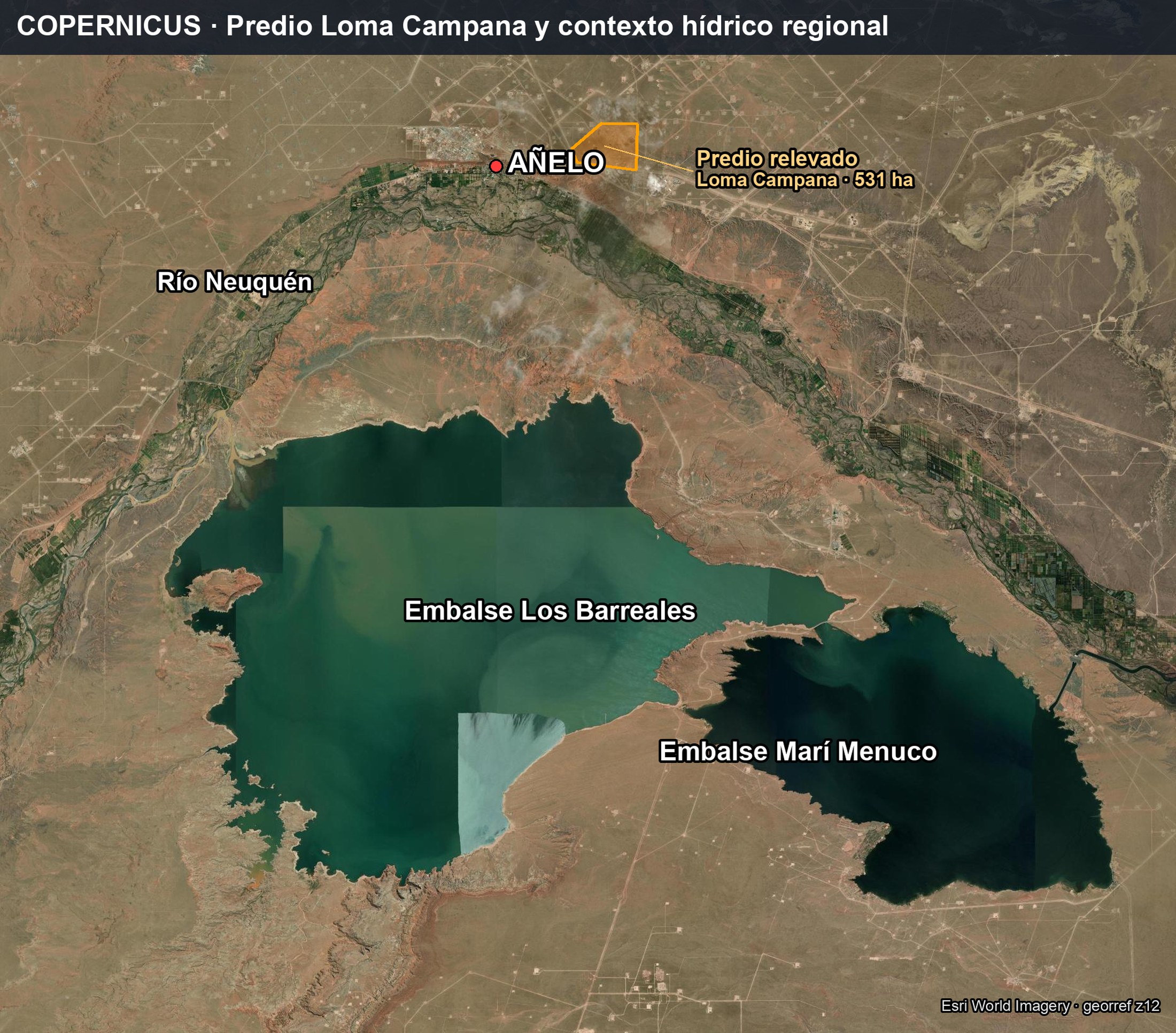
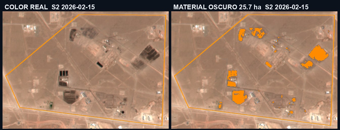
Waste cells and ponds: 25.7 ha
Over the true-colour image (left), the algorithm marks (right) the dark material within the site polygon, corresponding to the waste cells and fluid ponds. The detection coincides with the cells visible in the image. Total: 25.7 ha out of 531 ha surveyed (4.8% of the site area).
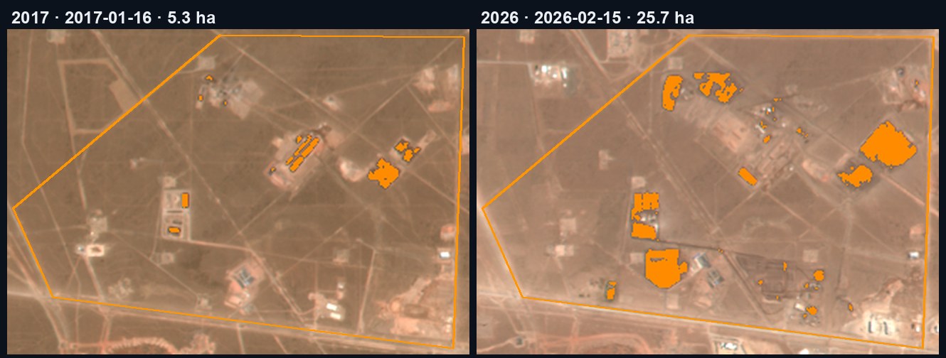
The waste and fluid footprint grew ≈5×
The same polygon and the same method, one summer pass per year. Cell surface area (dark material) went from 5.3 ha (2017) to 25.7 ha (2026): growth was concentrated between 2017 and 2019 and has since stabilised at around 25 ha.
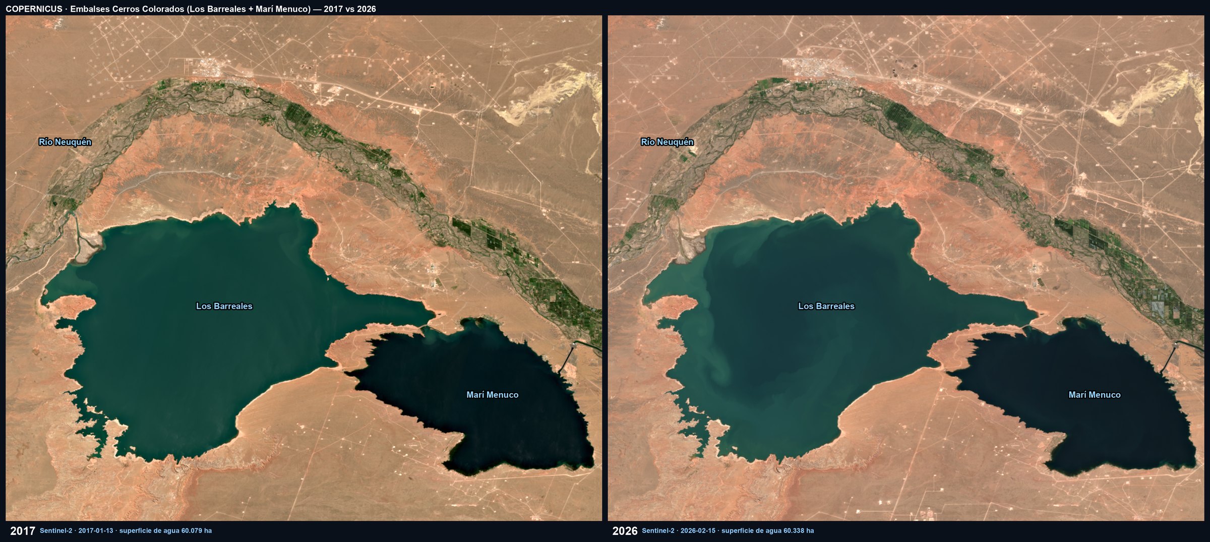
The reservoirs supplying the region: stable surface area
Independent measurement, using the same satellite, of the water surface area of the Cerros Colorados Complex reservoirs (Los Barreales + Marí Menuco), the regional freshwater and drinking-water supply. Between 2017 and 2026 the surface area fluctuated between 59,100 and 63,500 ha depending on wet and dry years, with no sustained trend: 59,133 ha in 2017 and 60,302 ha in 2026. No reduction in water surface area is observed.
The regulatory basis for monitoring
The management and disposal of hydrocarbon-industry waste and fluids is regulated. Continuous satellite monitoring provides objective, traceable, and auditable evidence.
Environmental protection of Neuquén (Preservación del medio ambiente de Neuquén). Environmental impact assessment and activity monitoring. Authority: Subsecretaría de Ambiente.
Water Code regulating water use and discharge: abstraction from sources and effluent disposal under water-authority control.
Hydrocarbon activity and surface rights: liability for soil and resources affected by operations.
All values are derived from Sentinel-2 (Copernicus Programme, ESA) at 10 m resolution, visually verified against the true-colour image. Satellite monitoring provides objective signal to prioritise where and when to inspect or sample; it does not determine composition or hazard, which require field measurement and sign-off by a licensed professional.